The Significance of the Sudanese Army’s Announcement of Liberating Khartoum Bahri
Sudan Events – Agencies
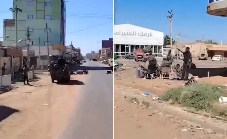
After nearly four months of intense battles in the northern part of Khartoum Bahri—the third city of Sudan’s capital—the Sudanese army regained control over the central and southern parts of the city, as well as its entrance to Khartoum, following limited confrontations with the Rapid Support Forces (RSF). The army has now moved closer to the Republican Palace, accelerating its efforts to seize control of key government buildings, ministries, and the international airport, according to observers.
This development comes just days after the army recaptured the Al-Jaili oil refinery (70 kilometers north of Khartoum), lifted the siege on the Signal Corps in the far south of Khartoum Bahri, and secured the General Command headquarters in the capital. The military is now implementing the third phase of its offensive, which began on September 26.
On Wednesday, Yasser Al-Atta, a member of the Sovereign Council and assistant to the army’s general commander, stated that “Khartoum Bahri is now clean and free of rebellion, from Al-Jaili refinery in the north to Al-Mak Nimir Bridge in the south.”
During his visit to Khartoum Bahri, Al-Atta affirmed that the city is now safe, with only a few remaining pockets of resistance. He emphasized that the army is working diligently to rid the country of rebellion.
This report explores the geographical location and economic significance of Khartoum Bahri, as well as the implications of its liberation on the ongoing military operations in the capital and its impact on local residents.
Where is Khartoum Bahri and What Are Its Geographical Boundaries?
The city extends from the banks of the Blue Nile in the south to the town of Qary on the border with the River Nile State in the north. It serves as the northern gateway to the capital, bordered to the east by East Nile locality and to the west by the Nile River, where the White and Blue Nile converge at Al-Mogran. With an area of 5,060 square kilometers, Khartoum Bahri covers a quarter of Khartoum State’s total land area.
The city is connected to Khartoum by four bridges: Al-Manshiya, Blue Nile, Armed Forces (Cooper), and Al-Mak Nimir, while it links to Omdurman through the Shambat and Halfaya bridges.
Commonly referred to as “Bahri” by its residents, the city forms part of the metropolitan “Triangular Capital” alongside Khartoum to the south and Omdurman to the west.
Despite being smaller in area and population compared to Khartoum and Omdurman, Bahri holds equal importance. It is one of Sudan’s largest industrial hubs and a crucial transit point, connecting the capital to northern Sudan via railways and to the south, reaching Kosti and South Sudan through Nile steamers. The city also serves as a peaceful tourist destination within the capital.
What is the Economic and Political Significance of the City?
Khartoum Bahri is the most industrialized part of the capital, hosting the largest industrial zone in Khartoum State. It accommodates factories for light food industries, grain mills, household appliances, clothing, as well as chemical, machinery, and equipment manufacturing.
Politically, the city has remained somewhat distant from the political turmoil of the Triangular Capital, except for the infamous Kober Central Prison, Sudan’s largest political detention facility. However, Bahri gained global attention in 1998 when the United States launched cruise missile strikes on the Al-Shifa pharmaceutical factory in its industrial zone. The attack was a U.S. response to the bombings of its embassies in Dar es Salaam and Nairobi, with then-President Bill Clinton alleging that the factory had ties to Osama bin Laden’s al-Qaeda network and was producing chemical weapons.
Additionally, the city is home to the headquarters of the Khatmiyya Sufi order, which forms the religious base of the Democratic Unionist Party.
What Does the Army’s Recapture of Khartoum Bahri Mean?
Security and military expert Abu Bakr Abdul Rahim told Al Jazeera Net that regaining control over Bahri secures the adjacent River Nile State, where RSF had previously spread into villages around Hajar Al-Asal near Al-Jaili refinery.
He further explained that the army’s control over the city reduces threats to Omdurman, as RSF had been launching deadly shelling attacks on neighborhoods in Karari locality, northern Omdurman, causing hundreds of casualties in recent months.
Notably, northern Bahri houses key military installations, including the Ordnance Corps in the Al-Kadro area and the Signal Corps on the Blue Nile in the south. The recapture of these areas now enables logistical links between army bases in Hatab and Al-Ailafoun in East Nile, expediting efforts to liberate that locality from RSF presence, according to the expert.
What Are the Potential Military Implications for Khartoum?
According to the military expert, army control over the Al-Mak Nimir Bridge (550 meters long), which is less than a kilometer from the Republican Palace, means its liberation is only a matter of time. The palace is now besieged, with army forces advancing westward from the General Command and additional forces moving eastward from Al-Mogran.
This also places strategic government institutions—including the Ministries of Defense, Foreign Affairs, Finance, Interior, and Federal Governance—along Nile Street within army firing range.
The expert further noted that with army troops advancing through Bahri, along with movements in the Al-Nasr Extension and Riyadh neighborhoods in East Khartoum, following the lifting of the siege on army headquarters and the expansion of Armored Corps operations toward central Khartoum, RSF forces are at risk of encirclement. This development could lead to the liberation of Khartoum International Airport and nearby neighborhoods in central and eastern Khartoum.
Additionally, army units in East Bahri can cross the Cooper Bridge after pushing RSF forces into East Khartoum, increasing pressure on them, especially after securing Al-Manshiya Bridge. This would leave RSF forces with no viable options—either flee or face elimination—due to being trapped in a confined area with no escape routes.
How Will Security Restoration Impact Bahri Residents?
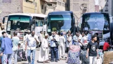
Administrative officer Omar Al-Badrabi, who has served in the city for many years, stated that the liberation of Bahri could allow over a million displaced residents to return to their homes, many of whom sought refuge in neighboring countries or were internally displaced.
Speaking to Al Jazeera Net, he added that most homes in northern, central, and southern Bahri remained structurally intact, as there were no direct battles in residential areas. However, personal properties and household furnishings were looted by RSF forces and criminals.
He also noted that water station damages could be repaired quickly if spare parts were available, though neighborhoods like Shambat, Al-Safia, and Kafouri suffered significant destruction.
It is worth mentioning that, since the liberation of northern Bahri areas—including Al-Kadro, Halfaya, and Al-Darushab—many displaced residents have returned from Egypt, Karari locality in Omdurman, and towns in northern and eastern Sudan, gradually restoring life to the region over the past two months.
Source: Al Jazeera Net