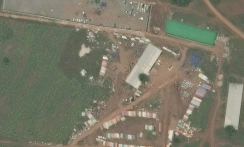
A recent analysis of satellite imagery released by the Humanitarian Research Lab (HRL) at the Yale School of Public Health has revealed continued significant military and logistical activity inside a base belonging to the Ethiopian National Defence Force in the city of Asosa.
The pattern of activity is consistent with the supply of equipment and military materiel to the Rapid Support Forces militia and its allies in Sudan’s Blue Nile State, amid reports of Emirati cargo aircraft flights to the neighbouring airport.
The report, issued on November 5 under the title Blue Nile Situation Update, was based on a comparison of satellite images captured between late October and early November with previously archived imagery.
The analysis revealed an expansion of the base’s infrastructure and a marked increase in the number of shipping containers, light combat vehicles, and transport trucks. An IL-76 cargo aircraft was also observed at Asosa Airport on October 30 and November 4. Open-source intelligence indicated that these flights originated from the United Arab Emirates.
The report documented continued construction work inside the base from mid-September through early November. The work included the creation of new concrete areas, the installation of a roof on a large building, and the appearance of additional excavators.
The analysis recorded a net increase of approximately 30 shipping containers during an initial phase, followed by the addition of at least 25 more containers.
On October 3, 27 cargo trucks were observed, most of them loaded, while on November 4, 11 trucks with double trailers were identified.
The laboratory also identified approximately 54 light combat vehicles inside the base, most of them white. It suggested that these vehicles may be undergoing repainting before being transferred to the Blue Nile front.
The report further noted that Ethiopia had recently ordered the Sudanese diplomatic mission to leave Asosa.
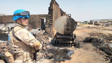
On the Sudanese side of the border, the report documented damage at at least six civilian locations inside Damazin, including Al-Zuhour neighbourhood, Souq Al-Sabeen, and Al-Alia neighbourhood. The damage included evidence of falling munitions and burn marks near a small market, a mosque, and residential areas.
These observations are consistent with local reports of drone attacks on the night of November 3 and the morning of the following day, which resulted in the killing of at least one woman.
The damage also extended to three military installations belonging to the Sudanese Armed Forces, including sites near Damazin Airport, the headquarters of the 44th Artillery Division, and the vicinity of the Fourth Infantry Division’s base.
The laboratory confirmed that the Sudanese Armed Forces’ military camp in the Sali area was destroyed between October 29 and November 4. This finding supports announcements made on November 3 by the Rapid Support Forces militia and the Sudan People’s Liberation Movement-North claiming control of the area.
Sali is located in a gold-mining area along the road linking Damazin and Kurmuk.
In the border town of Kurmuk, a significant RSF military presence was observed, comprising more than 20 light combat vehicles. Road levelling work and repairs to the Kurmuk Bridge were also recorded during the second half of October. Some of the vehicles bore colours similar to those seen at the Asosa base.
Humanitarian Situation
On the humanitarian front, the report recorded the emergence of more than 800 new shelters for displaced people in Damazin within a single month. Long queues were also observed outside fuel stations following the attacks.
The number of displaced people in Damazin locality exceeded 45,000 by mid-October, while approximately 120,000 people had been displaced from the localities of Geissan, Kurmuk, Bau, and Wad Al-Mahi since the beginning of the year.
The report stands out as independent evidence linking developments on the ground in Blue Nile State with cross-border logistical activity through Ethiopian territory, while highlighting the reported role of Emirati flights in sustaining this activity.
The laboratory emphasized, however, that satellite imagery alone cannot establish the precise contents of the shipments or their ultimate destinations. Nevertheless, the findings shed light on the role of border areas in exacerbating the humanitarian crisis.